
By Tamara Jager Stewart
“Here’s another Bob pile!”
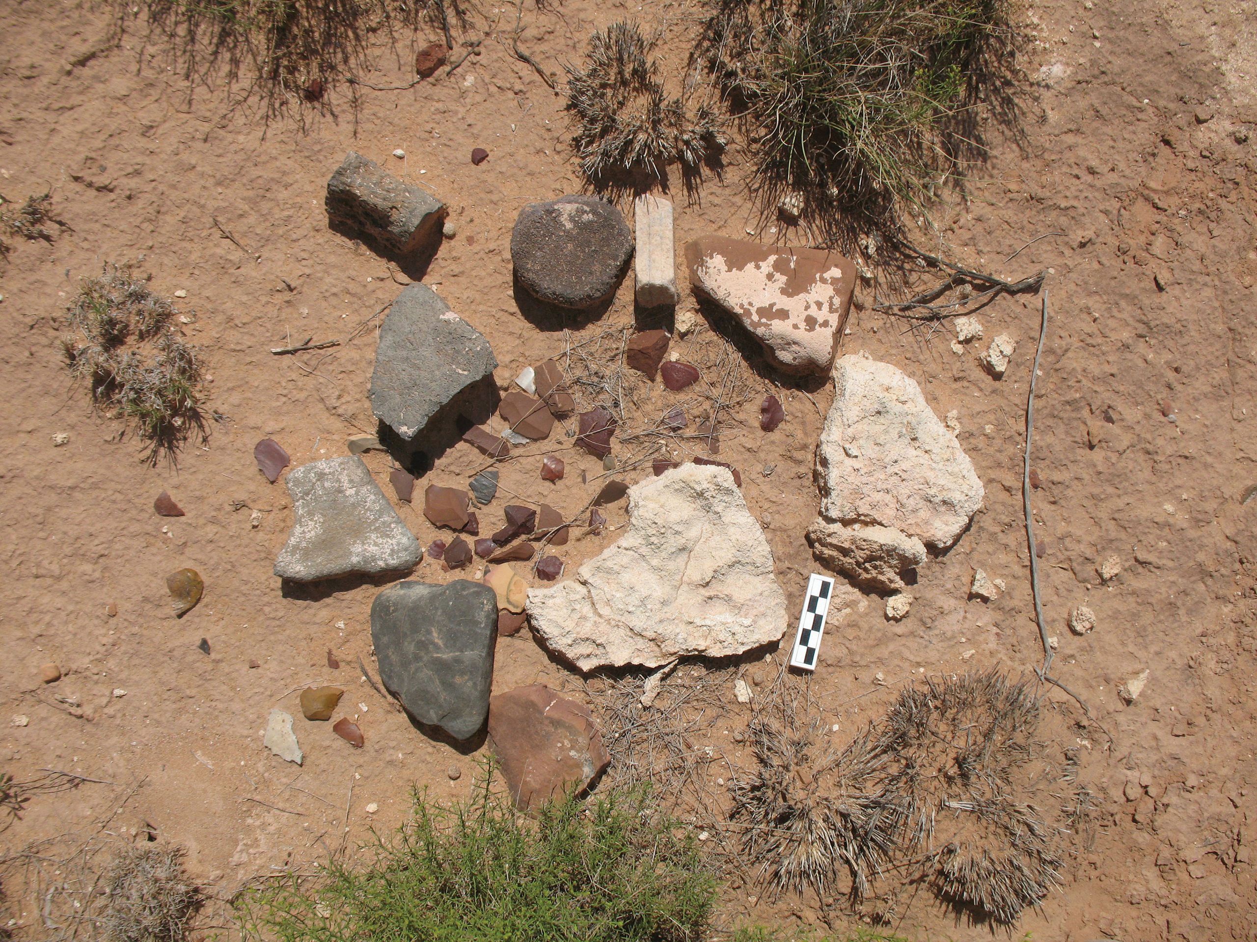
Bob pile, Mockingbird Gap
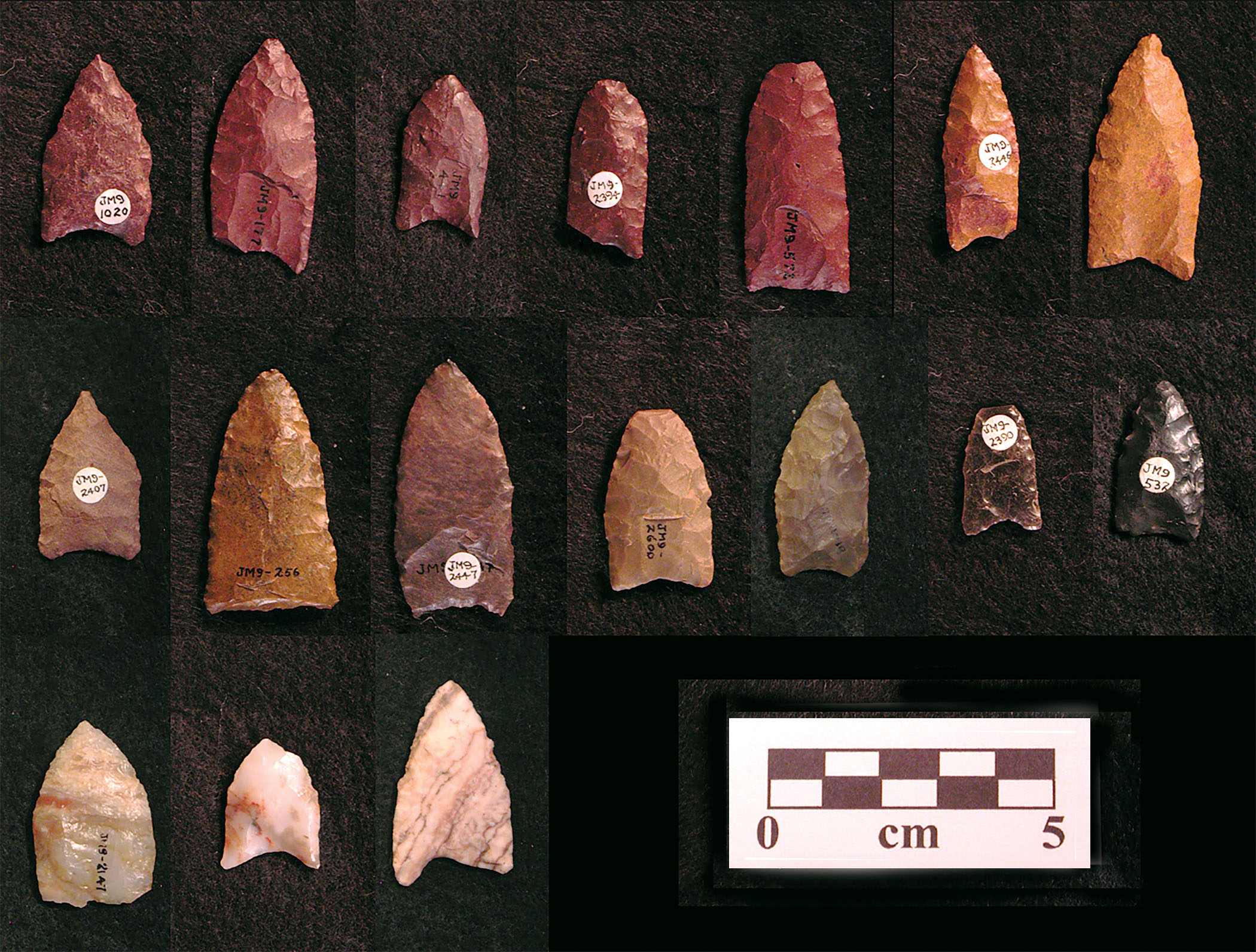
A graduate student points to a ring of rocks surrounding chips of flaked stone, one of hundreds that dot the dry desert floor of the Jornada del Muerto, or “Journey of the Dead Man,” the Spanish name for this barren 90-mile segment of the 17th-century Camino Real. Easy to miss at first, the rings, known as “Bob piles,” after professional geologist and avocational archaeologist Dr. Robert “Bob” Weber, who discovered the site in 1958 and spent the next five decades documenting it, are central to the story of Mockingbird Gap. While conducting geologic mapping for the N.M. Bureau of Mines and Mineral Resources, Weber walked much of Socorro County and the Jornada, recording more than 200 Clovis points at Mockingbird Gap and hundreds more across the region. He marked Clovis points and tools by placing stone rings around them, and over time, he added other surface artifacts as he came across them. He then plotted the piles on detailed maps along with the surrounding topography. The result is an unusually rich record of a site that otherwise might have seemed nearly impossible to interpret with older technologies.
“Unlike famous Clovis sites such as Blackwater Draw (the Clovis ‘type’ site, also in New Mexico), Mockingbird Gap was not buried just after it formed,” said Dr. Vance Holliday, University of Arizona (UA) emeritus professor of geoarchaeology. “It remained on the surface for some unknown amount of time until sand buried it. Parts have since been exposed by wind erosion.” While undertaken without a permit, Weber’s painstaking documentation of the site’s vulnerable surface remains preserved crucial spatial information.
“Paleoindian archaeology has long benefited from collaborations between professionals, avocationalists, and collectors—Weber was a combination of all of these,” said Dr. Chris Merriman, adjunct professor at Adams State College, who catalogued and analyzed the Weber collection for his dissertation research. Donated to the Museum of Indian Arts and Culture in Santa Fe after Weber’s death in 2008, the Robert H. Weber collection includes more than 15,000 individually cataloged artifacts, close to 500 pages of detailed notes, and topographic maps that cover nearly all of Socorro County. “Weber’s collection has long been considered one of the most extensive and detailed records of Paleoindian archaeology in the Southwest,” Merriman said. “It is no exaggeration to say we could take a Clovis point he collected over 50 years ago and literally put it right back where he found it. This level of detail opens an almost infinite amount of research potential.”
That research potential is what brought this team of archaeologists back to Mockingbird Gap. Since 2021, four principal investigators—Dr. David Kilby of Texas State University, Dr. Briggs Buchanan of the University of Tulsa, Dr. Marcus Hamilton of the University of Texas, and Merriman—have resumed work at the site with their graduate students. All four are University of New Mexico (UNM) graduates who previously worked at Mockingbird Gap with UNM professor of archaeology Dr. Bruce Huckell and Holliday, using Weber’s record as a foundation for new investigations into how Clovis groups lived, moved, gathered, and used this Ice Age landscape.
This is an excerpt of ‘Deciphering Mockingbird Gap’ in American Archaeology, Fall 2026, Vol. 30, No. 3. Subscribe to read the full text.